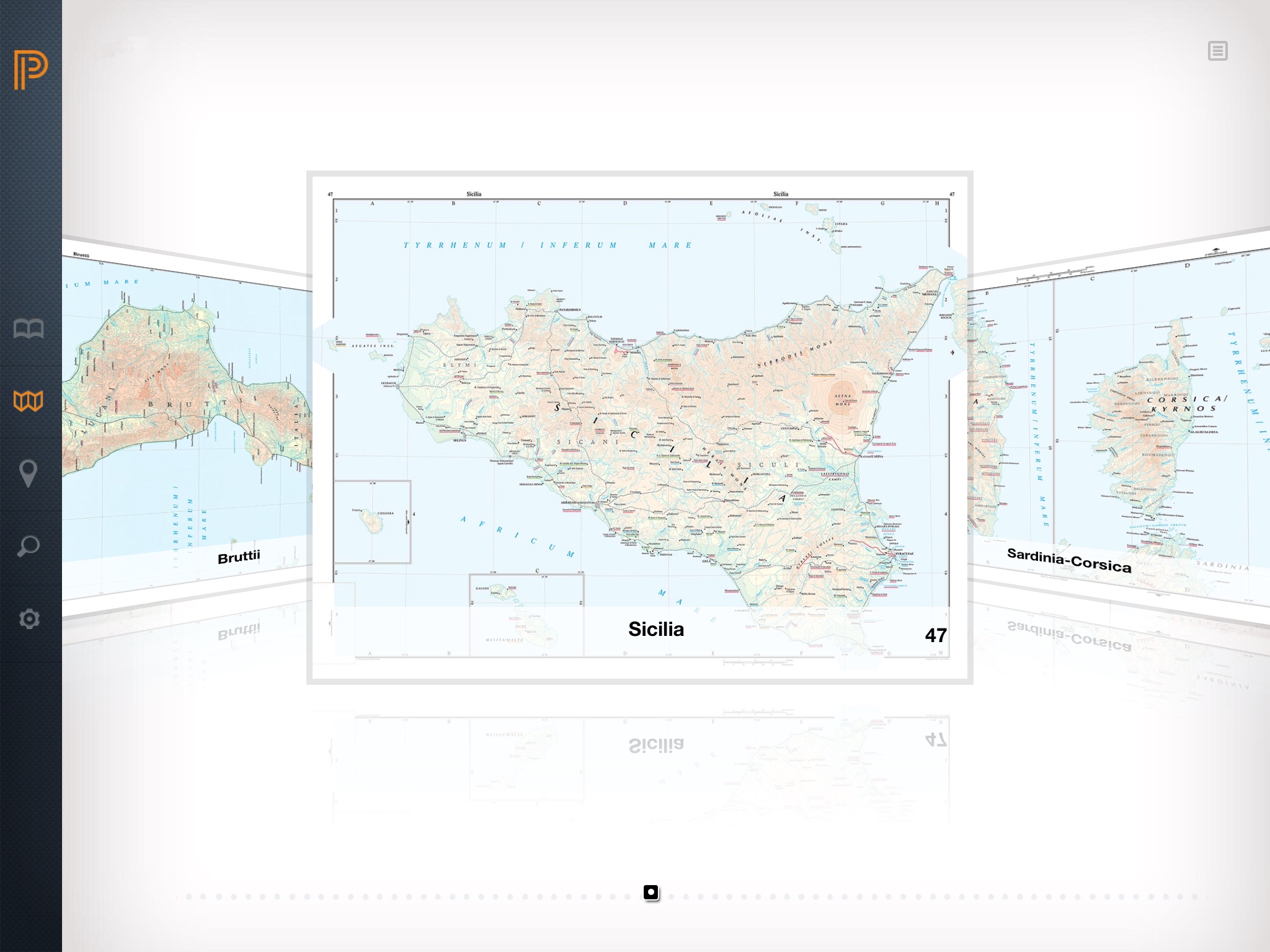
Hailed by the New York Times as "the best geography of the ancient world ever achieved" and deemed by classicist Bernard Knox to be "an indispensable tool for historians concerned with ancient times" as well as "a source of great pleasure for the amateur," the unsurpassed Barrington Atlas of the Greek and Roman World is now available in digital form as a full-featured app for the iPad. Including all the content of the $395 print edition of the Barrington Atlas, the app makes this essential reference work more portable and affordable than ever before possible.
In 102 interactive color maps, this app re-creates the entire world of the Greeks and Romans from the British Isles to the Indian subcontinent and deep into North Africa. Unrivaled for range, clarity, and detail, these custom-designed maps return the modern landscape to its ancient appearance, marking ancient names and features in accordance with modern scholarship and archaeological discoveries. Geographically, the maps span the territory of more than seventy-five modern countries. Chronologically, they extend from archaic Greece to the Late Roman Empire.
A must-have for scholars, this app will also appeal to anyone eager to retrace Alexanders eastward marches, cross the Alps with Hannibal, traverse the Eastern Mediterranean with Saint Paul, or ponder the roads, aqueducts, and defense works of the Roman Empire. Designed exclusively for the iPad, the app uses the latest technology and is available for iPad 2 and above.
This app has received a QED seal for quality in eBook design. It can be read easily on screens both large and small.
Features:
•Carry all the content of the Barrington Atlas of the Greek and Roman World on your iPad
•Explore and study on the go with interactive color maps and full-screen HD map images--all optimized for Retina Display
•Navigate maps with a finger swipe or tap
•Pinch-zoom up to 800 percent to see all detail
•Find more than 20,000 locations through an interactive gazetteer
•Bookmark locations for quick and easy access
•See all maps in proper orientation in both portrait and landscape modes through automatic "True North" rotation
•Look at maps in the same order as the book and move seamlessly between connected map plates without flipping pages
•View ancient borders or overlay modern borders for reference
•Examine maps in detail with an interactive map key
•Access maps through multiple, intuitive pathways provided by an easy-to-use interface
•Store all data locally on your iPad--no Wi-Fi or network connection necessary
Technical Specifications:
•Compatible with iPad 2 and above.
•Requires iOS 7.0 or later.
•Size: 350 MB
•Rating: Rated 4+
Reviews of print edition:
"[The Barrington Atlas] is the best geography of the ancient world ever achieved. . . . [I]t reveals the world inhabited or reached by the Greeks and Romans from 1000 B.C. to A.D. 640 in thrilling detail, and a color code lets us track changes through 16 centuries. The collective learning poured into this project is almost intimidating to contemplate, and the fact that it could be completed testifies to extraordinary planning, dedication and courage. . . . [T]he cartography is luminous. . . . [M]agnificent."
--D.J.R. Bruckner, New York Times Book Review
"The Barrington Atlas is a major contribution to scholarship, extensive in scale, reliable and up to date, and so laid out as to be really helpful to the user."
--Jasper Griffin, New York Review of Books
"Beautifully produced with an exquisite combination of scholarly precision and the highest level of cartographic art, this atlas is one of the greatest achievements in 20th-century Greek and Roman scholarship--and it probably will never be superseded."
--Publishers Weekly
"This atlas is an indispensable tool for historians concerned with ancient times. But it is also a source of great pleasure for the amateur."
--Bernard Knox, Los Angeles Times Book Review


